Explore Our

Innovative Drone Services

Discover cutting-edge aerial imaging, surveying, and inspection services tailored for your specific industry needs.

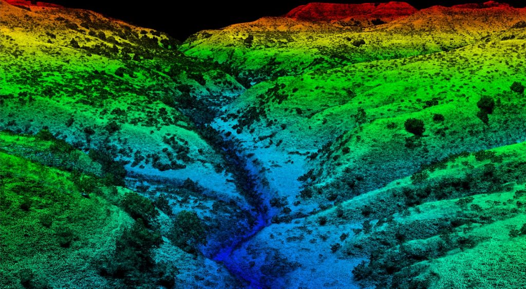
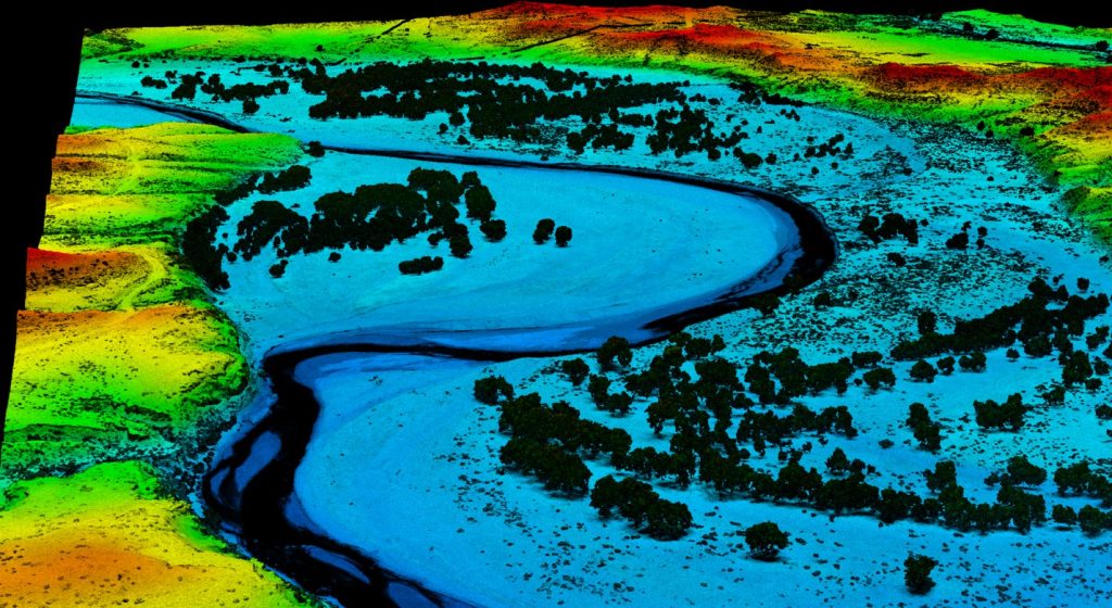
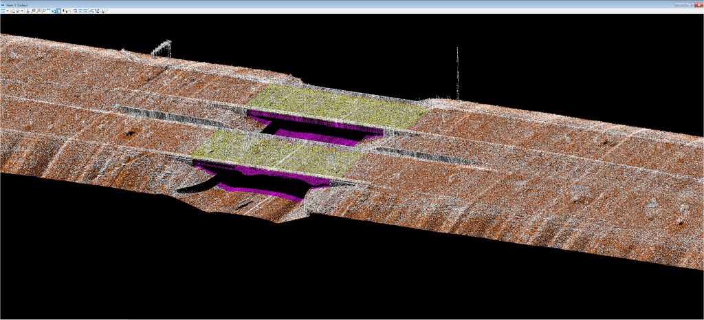
LiDAR Data Collection

  • lidar1
  • lidar2
  • lidar3

High-Precision 3D Mapping
Our UAV-based LiDAR systems capture millions of georeferenced data points per second, delivering highly accurate 3D point clouds for engineering, infrastructure, and environmental projects. With precision down to ±2.5 cm, LiDAR is ideal for creating digital terrain models (DTMs), digital surface models (DSMs), contour maps, and ground-classified datasets.Tailored drone services designed to meet your unique operational needs.

  • Applications:
  • Topographic mapping & site planning
  • Pre-design site surveys & grading plan
  • Corridor mapping for roads, rails & utilities
  • Cut/fill and construction progress analysis
  • Floodplain & drainage modeling
  • As-built verification
    Vegetation and forestry analysis
  • Cut/fill and volumetric calculations
  • Corridor mapping for utilities, pipelines, and roads

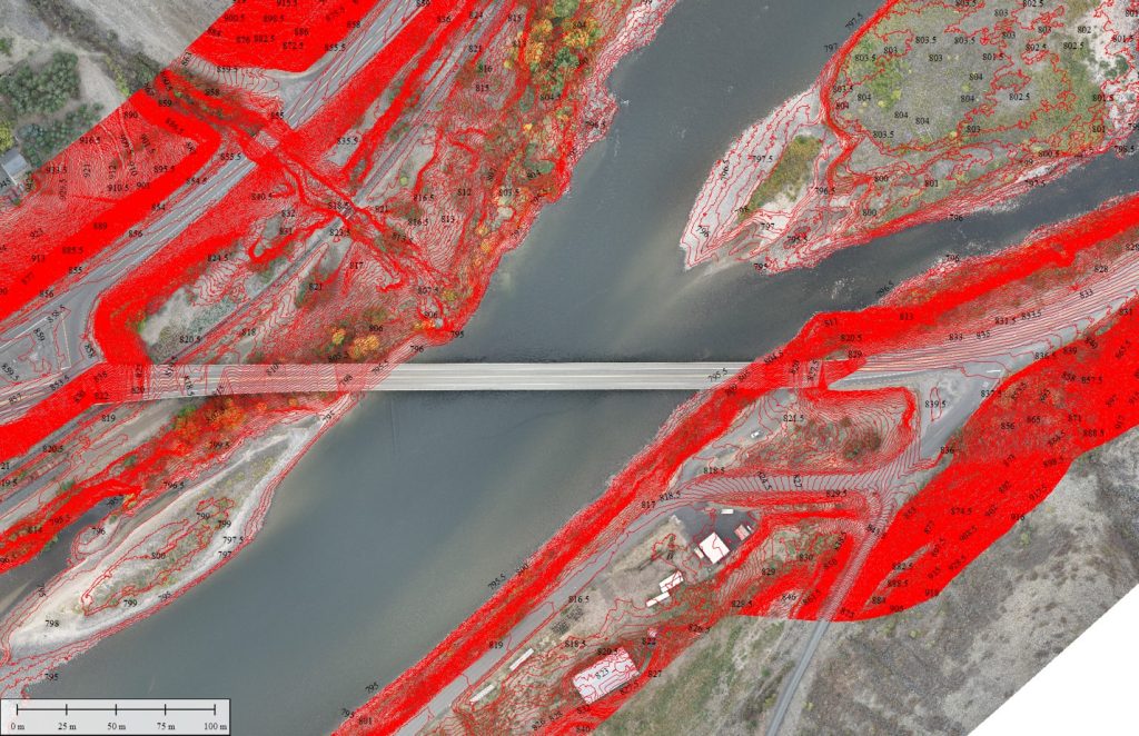
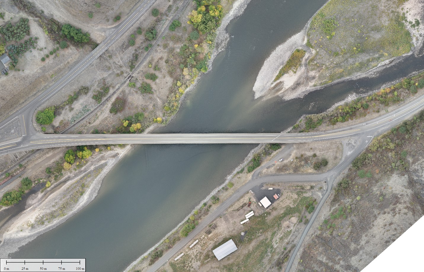
Photogrammetry Data Collection

  • ortho1
  • ortho

High-Resolution Aerial Imaging
Using advanced fixed-wing and multirotor UAV platforms, we capture overlapping high-resolution imagery for precise orthomosaic generation, 3D modeling, planimeterics and surface analysis. With GNSS-PPK workflows, we ensure sub-inch accuracy for geospatial deliverables

  • Applications:
  • Orthomosaics for site planning & designOrthorectified imagery for planning and inspection.
  • Change detection and progress monitoring
  • Stockpile and volumetric measurement
  • Structural inspection & documentation
  • 3D modeling for design integration.

Magnetometry Data Collection
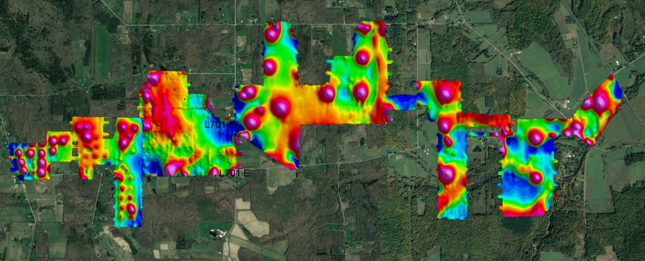
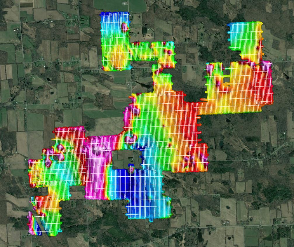
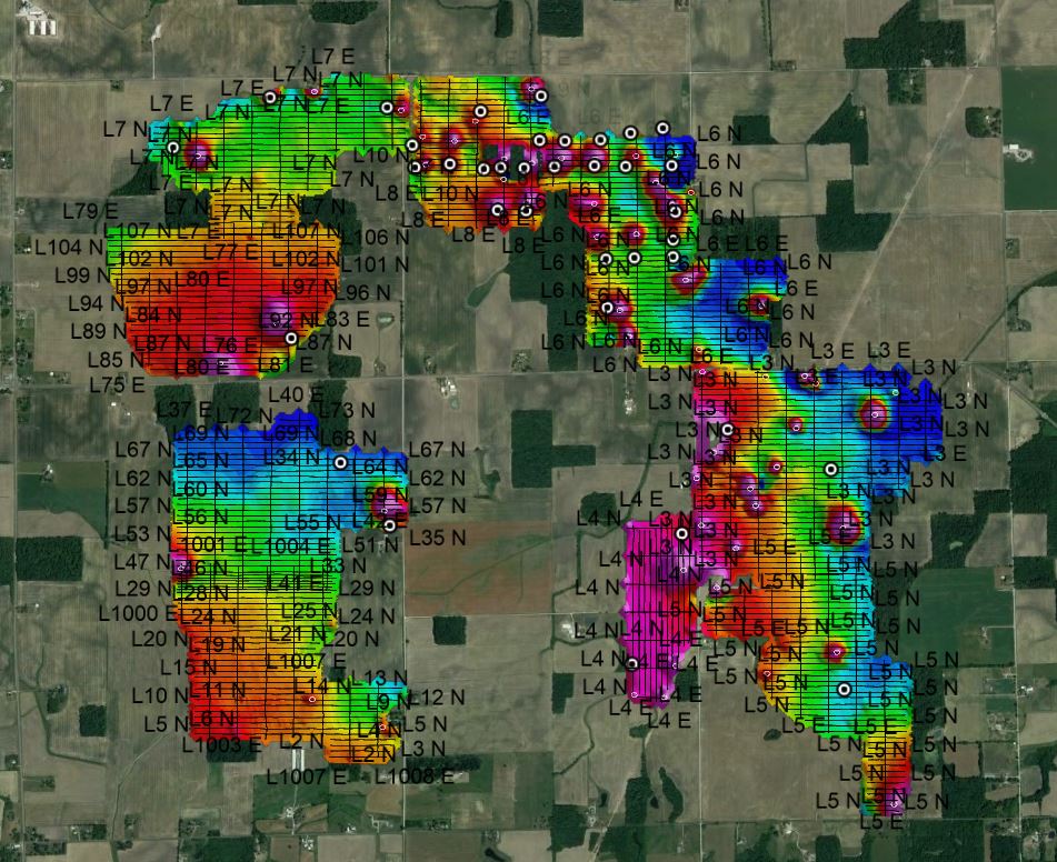
  • magentometer1
  • yb2
  • skycrest mag with flight lines (1)

Subsurface Target Detection
Our UAV-mounted magnetometers detect variations in the Earth’s magnetic field to identify buried metallic objects, wellheads, pipelines, and archaeological features without ground disturbance. This method provides rapid, large-area surveys with precision georeferencing.

  • Applications:
  • Locating orphaned or abandoned wellheads
  • Mineral exploration & deposit mapping
  • Mapping magnetic anomalies for resource assessment
  • Pipeline and infrastructure detection
  • UXO (Unexploded Ordnance) surveys
  • Archaeological site mapping

specialized Sensor Integrations

multispectral

Expanding Beyond the Standard
Our expertise goes far beyond our core in-house payloads. We’ve successfully integrated and operated a wide variety of advanced sensors to meet unique project needs. This includes multispectral cameras for vegetation and crop health analysis, ground penetrating radar (GPR) for subsurface structure mapping, thermal imagers for heat loss and wildlife studies, bathymetric LiDAR for underwater terrain mapping, methane detection sensors for leak identification in industrial settings and many more. Whether it’s a one-off mission or an ongoing monitoring program, we have the technical capability and flight experience to adapt our platforms for specialized data acquisition.

  • Applications:
  • Precision agriculture and vegetation analysis
  • Subsurface infrastructure and utility mapping
  • Heat signature and wildlife surveys
  • Hydrographic mapping and coastal studies
  • Environmental compliance and leak detection

Exclusive Offerings

Premium Drone Solutions

Explore our specialized services tailored for high-demand industries.

lidar2

LiDAR Services

UAV-based LiDAR systems capture millions of georeferenced data points per second

skycrest known wells with picks

Magnetometer

Advanced fixed-wing and multirotor UAV platforms

ortho

Photogrammetry

Integrated and operated a wide variety of advanced sensors

Ready to Get Started?

Contact us today for a personalized consultation.

Scroll to Top